


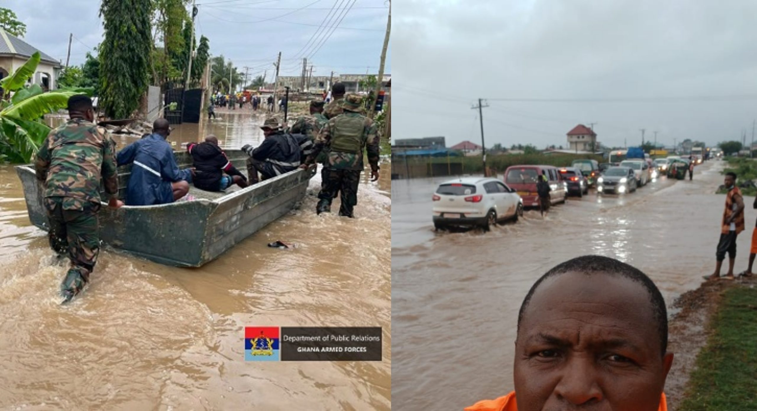
Flood-prone areas in Accra are no longer limited to familiar hotspots like Kaneshie and Odawna, as new communities including Achimota, Spintex and Madina are increasingly being hit by severe flooding during heavy rains. The latest downpours in 2026 left parts of the capital submerged, forcing emergency evacuations, disrupting transport routes and exposing how rapidly the city’s flood risk is expanding beyond its traditional drainage basins.
This story falls under News
Follow our WhatsApp channel for more interesting and relevant news
Urban planners and disaster officials say the capital is now experiencing a shift from isolated flood zones to a wider citywide risk pattern, driven by rapid development, blocked drainage systems and more intense rainfall events.
Traditional flood-prone areas in Accra still suffer repeated devastation
Some parts of Accra have remained flood-prone for decades due to their position along major drainage channels and low-lying terrain.
Odawna, around Kwame Nkrumah Circle, remains the most persistent flood basin in the capital. Heavy rainfall regularly overwhelms the Odaw River system, spilling water into surrounding commercial and transport corridors such as Adabraka, Kokomlemle and parts of the Ministries area.
Commercial hubs including Kaneshie, Abossey Okai, Tudu and Okaishie also continue to experience sudden flooding that disrupts trading activity and transport operations within minutes of intense rainfall.
In densely populated communities such as Nima, Alajo, Maamobi, Sukura, Chorkor and Old Fadama, flooding is often worsened by blocked drains, uncontrolled construction and limited stormwater infrastructure.
The western corridor — including Mallam, Sakaman, Mataheko, Glefe, Awoshie and Bubiashie — remains another major flood belt, especially during prolonged rainfall when runoff from higher ground overwhelms drainage channels.
These areas have repeatedly featured in flood alerts issued by disaster management authorities and remain central to emergency response operations during heavy rains. For context on how drainage failures are shaping urban risk, see our explainer on why Accra floods every year.
New flood hotspots are emerging across fast-growing suburbs
While historic flood zones remain active, recent rainfall events show that flooding is now spreading into middle- and upper-income residential areas that were previously considered safe.
Achimota, Atomic, Haatso, Ofankor and Amasaman have recorded increasing flash floods, particularly during short but intense downpours. Roads that were once passable now experience sudden waterlogging, cutting off movement and stranding residents.
In the eastern growth corridor, Spintex Road, East Airport, Tse Addo, Adjiringanor and Nmai Dzorn are increasingly affected due to rapid real estate development that has outpaced drainage planning.
Madina and Adenta also show rising vulnerability, especially in valley pockets and junction areas where water naturally collects during storms. Residents in these areas report more frequent flooding than in previous years.
Coastal communities such as Labadi, Osu, Teshie and Nungua are also under pressure as tidal influence combines with blocked drainage outlets, slowing the discharge of stormwater into the sea.
The expansion of flood impact zones has also been noted in emergency response operations during recent storms, where rescue efforts have extended beyond traditional hotspots into newer residential corridors.
Why Accra’s flood risk is expanding instead of shrinking
Experts point to three reinforcing factors behind the widening flood map.
First is unplanned urban expansion. Construction continues to spread into wetlands, waterways and natural drainage paths, reducing the land’s ability to absorb rainfall.
Second is drainage blockage. Plastic waste, silt and poor maintenance continue to choke storm drains, especially in densely populated and commercial areas where runoff is highest.
Third is rainfall intensity. Recent weather patterns show shorter but heavier storms, which overwhelm drainage systems even in areas that previously handled rainfall better.
Together, these factors have shifted Accra’s flooding from a set of predictable zones into a connected citywide risk system affecting both old and new suburbs.
What the expanding flood map means for residents and planning
The widening of flood-prone areas has major implications for urban safety and infrastructure planning.
Areas once considered safe are now experiencing conditions similar to long-established flood zones, increasing the scale of emergency evacuations and response operations during storms.
Disaster agencies continue to carry out rescue missions during extreme rainfall, but officials warn that long-term solutions will depend on stronger drainage investment, tighter land-use enforcement and improved waste management systems.
Without structural changes, experts caution that more neighbourhoods could be added to the flood-risk map in the coming years as urban expansion continues.
Related reads
- Mahama orders GHS300m emergency release as Accra floods kill 12
- Tonnes Of Plastic Waste Wash Onto Laboma Beach After Deadly Accra Floods
- Floods and fuel: Here’s why motorists are being urged to think twice before filling up
- Mahama proposes new city as answer to Accra’s deadly floods
Explore more:
News | Business | Entertainment | Lifestyle | Sports